Keyword
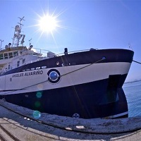
Angeles Alvarino
175 record(s)
Type of resources
Categories
Topics
INSPIRE themes
Keywords
Contact for the resource
Provided by
Years
Formats
Status
-

Estudio del Banco Chella o Seco de los Olivos en la costa sudeste de Almeria
-

Research and identification of sunken vessels
-

The main objevtive of the FAUCES 1 bis is the identification of the rececent morphosedimentary feaures of two submarine canyons in the Albroan sea , Guadiaro and Garrucha. To achive this general objetive, we adquire data with the TOPAS system and the mulbeam bathimetry.
-

Make the underwater archaeological chart of the coast of Murcia.
-

Se pretende continuar con las labores acometidas en la Primera Campaña realizada en el 2015 en lo referido al conocimiento del pecio: - Extensión del pecio. - Estado de conservación de los materiales. - Dispersión de los restos del buque español. - Continuar con el “mapeado” arqueológico. - Avanzar en la interpretación y análisis del pecio. - Extracción de los siguientes elementos, basada en motivaciones de carácter histórico‐culturales, museográficas, de conservación, archivísticas y jurídicas: a.‐ Culebrina de bronce del siglo XVI. Peso aproximado: entre 1.300 y 1.800 Kg. b.‐ Un “cañón pedrero” u “obús de a tres”, de bronce. Pareja del extraído en 2015. c.‐ Elementos de la vajilla de plata estropeada (plata de chafalonía) que figura en la documentación del AGI. d.‐ También se extraerán algunos elementos que en el 2015 se filmaron y cuya función desconocemos. e.‐ Dependiendo de las circunstancias de la Campaña, es posible que se proceda a extraer la segunda culebrina de la Mercedes.
-

1.- Se pretende ubicar en la estricta verticalidad del pecio un barco de tecnología moderna que tenga la posibilidad de transportar y hacer operativo un ROV. Dicho ROV deberá ser capaz de descender hasta los 1200 metros del objetivo, y pasar varias horas de trabajo diarias filmando y fotografiando los restos del pecio. Por lo tanto debe entenderse que la clara finalidad de esta Campaña estriba en la documentación, “mapeado” arqueológico e interpretación y análisis del estado actual del pecio. 2.- Además de lo anterior, se pretende realizar la cartografía de la zona de hundimiento de la Fragata Nuestra Señora de Las Mercedes. Para ello, con la sonda multihaz EM710 se llevará a cabo un levantamiento batimétrico sistemático de la zona del hundimiento con recubrimiento redundante solapando al 100%, con los haces cerrados al máximo y velocidad no superior a 5 nudos. De estemodo, se consigue una elevada densidad de puntos sondados que permitirá realizar una cartografía de gran resolución.
-

Historical series of oceanographic data in the Coruña Estuary and adjacent platform.
-

This survey has been projected in the frame of La Restinga Volcano monitoring. After a wide number of surveys conducted by R/V Ramon Margalef during the volcano crissis (from october 2011 to february 2012) the aim this time is to compleate a bathymetric surver again in order to find out possible changes in geomorphology, Sound velocity profiles will be carried out in order to obtain the best accuracy on the data adquired.
-

The goals of this survey are framed within the educational activity of the Faculty of Marine Sciences ULPGC to give the possibility of a complete oceanographic study (Physical , Chemical , Biological and Geological Survey ) in the south of Gran Canaria students of Degree, Bachelor and Master , the convergence zone between the area and the trail of the island and the presence of permanent rotation south of it. Thus this survey will contribute to a comprehensive training for students in oceanographic study of an oceanic region may Determine the structure of water bodies, the effects of convergence and divergence to the passage of the Canary Current across the channels between islands, mass transport , and nutrients. Determine the distribution of chemical species , including oxygen and carbon dioxide system and quantify the transport of CO2 in the atmosphere-ocean study area , the effect of micro and mesoscale phenomena in their distribution. To characterize the effect of the wake , turns and other mesoscale structures in the distribution of species of phytoplankton and zooplankton.
-

Historical series of oceanographic data in the Vigo Estuary and adjacent platform.
 Catálogo de datos del IEO